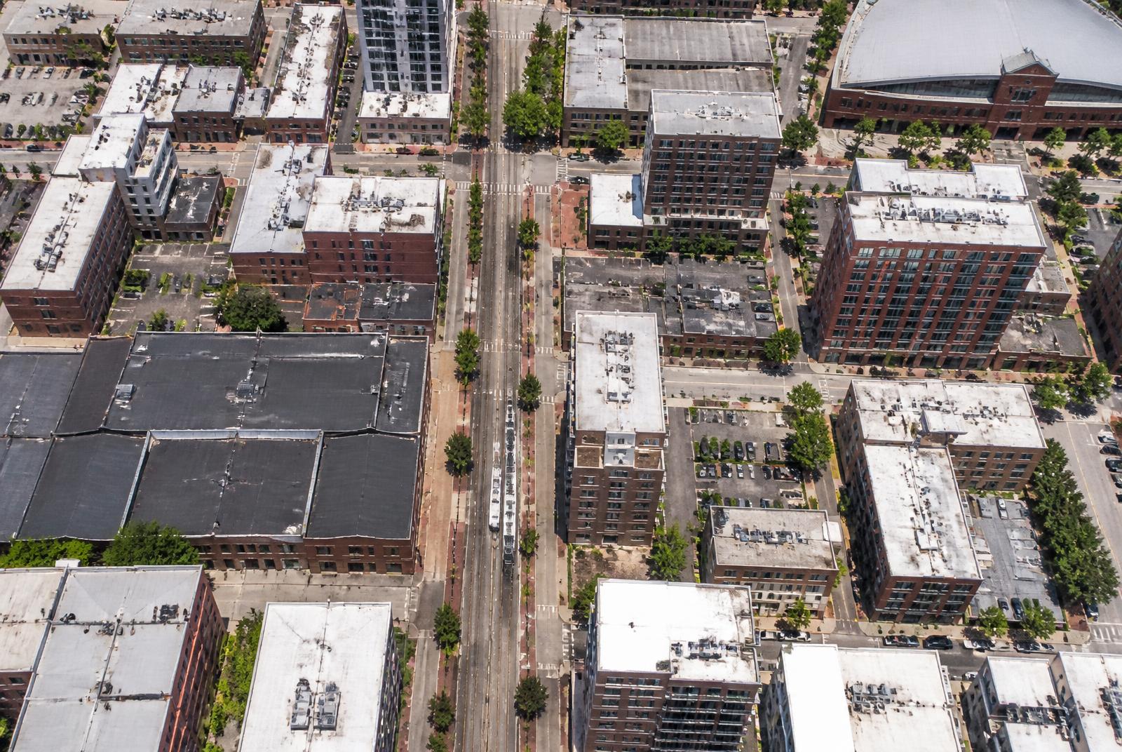
Overhead aerial view of the South End Charlotte street grid, warehouses, and light rail line

Orientation

Where Is South End, Charlotte?

South End runs southwest from the edge of Uptown along the light-rail corridor. Learn the stations and the two or three main streets, and the whole district falls into place.

Southwest of Uptown

Position

28203

Primary ZIP code

LYNX Blue Line

Spine

Approximate

Boundary precision

The short answer

South End is a district of Charlotte, North Carolina, immediately southwest of Uptown, organized along the former rail corridor that now carries the LYNX Blue Line light rail and the Charlotte Rail Trail. Most of it falls within the 28203 ZIP code.

It is not a separate town, not part of Uptown, and not the same as Dilworth. It is a named district within the city, with boundaries that are widely understood in general terms and debated at the edges. Descriptions here are approximate; for official boundary and planning geography, consult the city's planning resources and the county's parcel viewer.

What borders it

To the northeast is Uptown, separated by the Interstate 277 loop. To the east lies Dilworth, across South Boulevard and the rail line. To the west is Wilmore, a residential neighborhood of smaller houses. To the southwest, past the district's busiest blocks, are Sedgefield and the area commonly called LoSo — Lower South End — where the character turns lighter-industrial before it turns residential again.

Confusing these areas is the most common orientation mistake. Listings and casual usage stretch the South End label outward in every direction because the name carries weight, so verify a specific address rather than trusting a marketing description.

  • Northeast: Uptown, across I-277
  • East: Dilworth
  • West: Wilmore
  • Southwest: Sedgefield and LoSo

Orient yourself by station

The simplest mental map of South End is the sequence of Blue Line stations running through it. Each station anchors a cluster of buildings, restaurants, and retail, and residents routinely describe where they live by naming the nearest one rather than by street address.

Because the rail line runs on a northeast–southwest diagonal rather than along the compass grid, directions here can feel disorienting at first. Think of the line as the spine and everything else as ribs branching off it, and the geometry stops being confusing.

The main corridors

South Boulevard is the district's arterial, running parallel to the rail line and carrying most of the through traffic. Camden Road runs alongside the trail through the busiest restaurant and retail blocks. South Tryon Street forms the western side of the corridor. Cross streets including Morehead, Tremont, Bland, and East–West Boulevard connect across the line and are how you move between the eastern and western halves.

The Rail Trail runs beside the tracks for the length of the district, crossing those streets at grade. Learning which crossings are signalized and which are not is the practical part of navigating South End on foot or by bike.

  • South Boulevard — arterial, parallel to the rail line
  • Camden Road — trail-adjacent retail and restaurant spine
  • South Tryon Street — western edge of the corridor
  • Morehead, Tremont, Bland, East–West — cross-corridor connections

Sub-districts within South End

Locals subdivide the district further: the Design District toward the northern end, the historic mill blocks around the old textile buildings, the dense trail core, and LoSo toward the southwest. These are informal names, not official boundaries, but they describe genuine differences in building type, density, and how the street feels at night.

Our neighborhoods guide breaks these down individually, which is more useful than a single boundary line when you are deciding where inside the district to live or eat.

Driving and arriving

By car, South End is reached from I-277 at the north end and from South Boulevard and South Tryon from the south. Parking is predominantly structured and often paid, with limited on-street supply that fills on weekend evenings.

By rail, any Blue Line train serving the corridor puts you in the district. By bike or on foot from Uptown, the Rail Trail provides a continuous connection that avoids the arterial crossings entirely — generally the most pleasant way to arrive.

At a glance

What matters most here

Southwest of Uptown

Outside the I-277 loop, along the Blue Line corridor, mostly in 28203.

Not Uptown, not Dilworth

It borders both and is regularly confused with both in listings.

Navigate by station

The rail stations, not the street grid, are how residents describe location.

Boundaries are approximate

Edges are debated; verify a specific address against official planning geography.

Orientation

Where this sits in South End

Everything in the district is measured against the Blue Line and the Rail Trail. Use the map to place the blocks referenced above.

N ↑Morehead StEast/West BlvdTremont AveUptown CharlotteCarson StationBland Street StationEast/West Blvd StationNew Bern StationCharlotte Rail TrailAtherton MillDesign DistrictBrewery RowWilmoreDilworthSedgefieldLoSoLowe's Tech Hub

Interactive map

Hover or tap a marker

The Blue Line runs the length of South End on a northeast–southwest diagonal, with the Rail Trail beside it. Nearly everything in the district is measured by how far it sits from that spine.

  • Blue Line station
  • Landmark
  • Sub-district
  • Employer / anchor

Answered

Questions & Answers

Where is South End in Charlotte, NC?

Immediately southwest of Uptown Charlotte, running along the LYNX Blue Line and South Boulevard corridor, primarily within the 28203 ZIP code.

Source: Charlotte Area Transit System — LYNX Blue Line

What are South End's boundaries?

Approximately Uptown and the I-277 loop to the northeast, Dilworth to the east, Wilmore to the west, and Sedgefield and LoSo to the southwest. Edge definitions vary; consult official planning geography for precision.

Source: Mecklenburg County POLARIS 3G parcel viewer

What ZIP code is South End Charlotte?

Most of the district falls in 28203, though addresses at the edges can fall into adjoining ZIP codes.

Source: City of Charlotte

Is South End walkable from Uptown?

Yes. The Rail Trail provides a continuous walking and cycling connection, and the Blue Line covers the distance in a few minutes.

Source: Charlotte Area Transit System — LYNX Blue Line

How many light rail stations are in South End?

Several Blue Line stations serve the district along its length, and residents commonly orient themselves by the nearest one rather than by street address.

Source: Charlotte Area Transit System — LYNX Blue Line

Is LoSo part of South End?

LoSo, short for Lower South End, refers to the area southwest of the district's core. It is generally treated as an extension or sub-district rather than a separate neighborhood, but usage varies.

Source: Charlotte Regional Business Alliance

Primary Sources

Figures are compiled from public records and primary sources and are reviewed periodically. Conditions in South End change quickly — verify anything you intend to rely on.