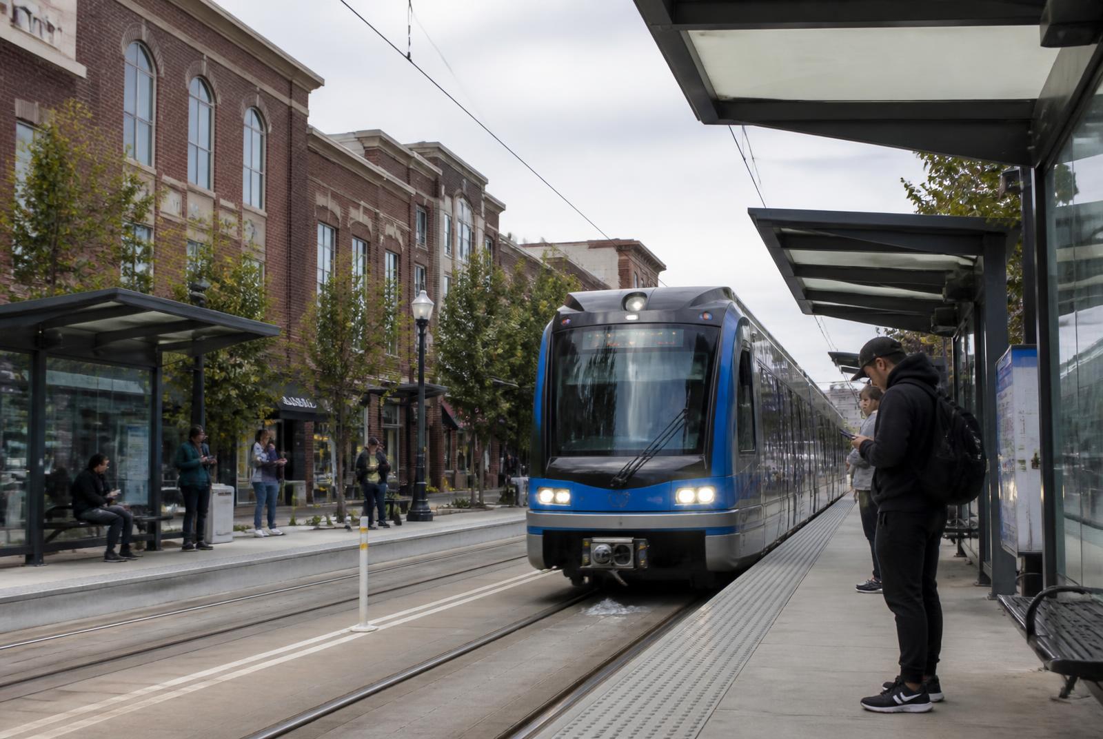
A LYNX Blue Line light rail train at a South End Charlotte station platform

Transit & Access

The LYNX Blue Line Through South End

South End owes much of its current shape to the LYNX Blue Line, whose four stations here — Carson, Bland Street, East-West Boulevard, and New Bern — set the framework for the transit-oriented zoning that followed.

4

LYNX stations in South End

~10 min

typical ride to Uptown

TOD

zoning overlay along the corridor

2000s

era the Blue Line opened

Four Stations, One District

South End's stretch of the Blue Line includes Carson, Bland Street, East-West Boulevard, and New Bern stations, each anchoring a slightly different pocket of the district. Carson sits closest to Uptown and the Design District, while New Bern and East-West Boulevard serve the district's more residential southern edge near Wilmore and Sedgefield.

Scaleybark station, just south of the district's edge, marks the transition point where South End gives way to LoSo and the corridor's character shifts from dense mixed-use back toward lower-scale commercial and residential blocks.

The spacing between stations is tight enough that many South End residents can walk to more than one station depending on their destination, which has reinforced the district's overall walkability rather than concentrating activity around a single stop.

Getting to Uptown and the Airport

A ride from any South End station to Uptown's core takes roughly ten minutes or so, which has made the district one of the most viable car-free commuting options for people working in Uptown's office towers.

Reaching Charlotte Douglas International Airport requires a transfer, since the Blue Line does not run directly to the airport terminal; riders typically connect to a bus route or rideshare from an Uptown or South End station rather than riding rail the entire way.

Because of that transfer, many South End residents treat the airport connection as a convenience for light luggage trips rather than a primary travel method, opting for rideshare on heavier travel days.

How TOD Zoning Changed the Rules

Charlotte's transit-oriented development zoning, applied along the Blue Line corridor, allowed greater density and reduced parking minimums near station areas in exchange for design standards meant to keep buildings pedestrian-friendly at street level.

In South End, that trade-off is visible in the near-continuous run of mid-rise apartment and mixed-use buildings within a short walk of each station, built at a scale that would not have been permitted under the district's older industrial zoning.

The TOD overlay also pushed parking underground or into structured decks wrapped by active ground-floor uses, a pattern now common enough in South End that surface parking lots near the stations have become the exception rather than the rule.

Station Areas in Practice

Carson station sits closest to the district's oldest adaptive-reuse buildings and functions as an informal gateway between Uptown and South End's commercial core.

Bland Street station anchors a stretch that mixes newer residential towers with some of the district's remaining light-industrial buildings, a combination that gives this section a slightly rougher edge than the polished blocks near Atherton Mill.

East-West Boulevard and New Bern stations serve the district's quieter southern half, where development has been steadier but less dense than the northern stations closer to Uptown.

  • Carson — closest to Uptown, near Design District core
  • Bland Street — mix of newer towers and light-industrial buildings
  • East-West Boulevard — southern residential edge
  • New Bern — transition toward Wilmore and Sedgefield

Riding the Line Day to Day

Trains run frequently enough during peak commuting hours that most riders don't plan around a printed schedule, though headways stretch out later in the evening and on weekends.

Platforms at each South End station are simple and open-air, with real-time arrival displays and direct sidewalk or trail access rather than parking structures, reinforcing the corridor's pedestrian-first design.

Ridership patterns shift noticeably on weekends, when trips skew toward breweries and restaurants near Atherton Mill rather than the weekday commuter flow toward Uptown offices.

What the Line Means for Property Values

Proximity to a station has consistently been one of the strongest factors in South End real estate pricing, with buildings inside an easy walk of Carson or Bland Street commanding a premium over comparable properties further from the tracks.

That premium has also driven redevelopment pressure on some of the district's remaining older or lower-density parcels near the stations, as the underlying land becomes more valuable than what's currently built on it.

Buyers and renters researching South End should treat walk time to a station as a meaningful variable, since it affects not just convenience but the pace of change likely to happen on a given block.

At a glance

What matters most here

Carson Station

The northernmost South End stop, closest to Uptown and the Design District's converted warehouses.

TOD Overlay

Reduced parking minimums and greater density near stations reshaped what could be built along the corridor.

No Direct Airport Line

Reaching the airport requires a transfer from the Blue Line to bus or rideshare.

Orientation

Where this sits in South End

Everything in the district is measured against the Blue Line and the Rail Trail. Use the map to place the blocks referenced above.

N ↑Morehead StEast/West BlvdTremont AveUptown CharlotteCarson StationBland Street StationEast/West Blvd StationNew Bern StationCharlotte Rail TrailAtherton MillDesign DistrictBrewery RowWilmoreDilworthSedgefieldLoSoLowe's Tech Hub

Interactive map

Hover or tap a marker

The Blue Line runs the length of South End on a northeast–southwest diagonal, with the Rail Trail beside it. Nearly everything in the district is measured by how far it sits from that spine.

  • Blue Line station
  • Landmark
  • Sub-district
  • Employer / anchor

Answered

Questions & Answers

Which LYNX stations serve South End?

Carson, Bland Street, East-West Boulevard, and New Bern stations sit within South End, with Scaleybark just south marking the edge of the district.

Source: Charlotte Area Transit System — LYNX Blue Line

How long does it take to reach Uptown from South End on the Blue Line?

Rides from South End stations to Uptown's core generally take roughly ten minutes, depending on the specific station and time of day.

Source: Charlotte Area Transit System — LYNX Blue Line

Does the Blue Line go to the airport?

Not directly. Riders need to transfer to a bus route or use rideshare to complete the trip to Charlotte Douglas International Airport.

Source: Charlotte Area Transit System — LYNX Blue Line

What is transit-oriented development zoning?

TOD zoning allows greater density and reduced parking requirements near transit stations in exchange for pedestrian-friendly design standards, and it's the framework behind much of South End's mid-rise construction.

Source: City of Charlotte Unified Development Ordinance (2023)

Is South End walkable to more than one station?

Yes — station spacing is close enough that many residents can reach two stations on foot depending on their destination.

Source: Charlotte Area Transit System — LYNX Blue Line

Do trains run late at night?

Service continues into the evening but with longer gaps between trains than during peak commuting hours.

Source: Charlotte Area Transit System — LYNX Blue Line

Primary Sources

Figures are compiled from public records and primary sources and are reviewed periodically. Conditions in South End change quickly — verify anything you intend to rely on.