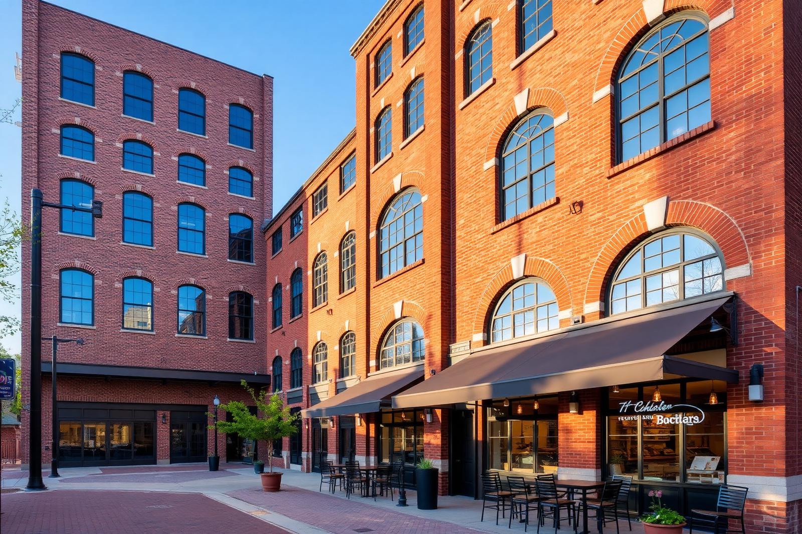
Restored red-brick textile mill in South End converted to shops and restaurants

District History

The History of South End

South End's name comes directly from its geography — the southern end of Charlotte's original streetcar and rail lines — and its transformation from working mill corridor to modern mixed-use district has unfolded over more than a century.

Late 1800s

earliest rail and mill development

Streetcar era

origin of the district's name

1990s

start of the modern revitalization push

2000s onward

LYNX-driven redevelopment

Where the Name Comes From

South End takes its name from its position at the southern terminus of Charlotte's early streetcar and rail lines, which ran south from Uptown along the corridor that today carries the LYNX Blue Line. The name was descriptive rather than aspirational — it simply marked the end of the line.

That rail line attracted the textile mills that would define the area's economy for decades, since manufacturers wanted direct rail access to move cotton and finished goods, and South End's flatter land south of Uptown offered room for mill buildings and worker housing alike.

By the early 20th century, the name had stuck as shorthand for the industrial corridor south of the city center, distinct from the residential streetcar suburbs like Dilworth developing nearby around the same era.

The Mill and Rail Economy

For much of the early-to-mid 20th century, South End functioned as a working industrial district built around textile manufacturing, with mills including Atherton operating alongside rail-served warehouses and light industry.

Neighborhoods bordering the corridor, including parts of Wilmore, grew up largely to house mill workers, establishing a residential-industrial pattern that shaped the area's physical layout for decades afterward.

This period gave South End its architectural inheritance — brick mill buildings, warehouse structures, and rail infrastructure — that would later prove central to its redevelopment rather than an obstacle to it.

Decline in the Mid-20th Century

As textile manufacturing moved away from the Carolinas piedmont through the mid-to-late 20th century, South End's mills gradually closed or scaled down, leaving behind vacant industrial buildings and a district with fewer jobs than it once supported.

Without the mills' economic base, the area saw less private investment for decades, and by the 1980s much of South End's building stock sat underused relative to its potential, even as neighboring Dilworth and Wilmore remained stable residential areas.

This period of relative neglect is part of why so many of the district's older buildings survived largely intact — there simply wasn't enough investment pressure to redevelop or demolish them during those decades.

The 1990s Revitalization Effort

By the late 1990s, a coordinated push began to revitalize South End, with public and private interests recognizing the potential in the district's vacant mill and warehouse buildings. Early adaptive-reuse projects, including at Atherton Mill, demonstrated that these buildings could support retail, office, and residential uses rather than sitting empty.

This period also marked the district's rebranding push, with the name 'South End' promoted more deliberately as a distinct identity for the area, separate from its industrial-era reputation, to attract businesses and residents.

Charlotte Center City Partners and city planning efforts supported this transition, helping coordinate infrastructure and zoning changes that would later be reinforced by the arrival of light rail.

The Light Rail Turning Point

The opening of the LYNX Blue Line brought the single largest catalyst to South End's modern redevelopment, running along the same corridor the district's original rail lines once occupied and giving new relevance to that historic right-of-way.

Transit-oriented development zoning applied along the corridor allowed denser mixed-use construction near the stations, accelerating a wave of apartment and retail development that built directly on the momentum the 1990s revitalization effort had started.

The Charlotte Rail Trail followed, running alongside the tracks and further reinforcing the corridor as the district's central spine, connecting stations, breweries, converted mills, and new residential towers along a single pedestrian route.

South End Today

The district today mixes preserved mill buildings, mid-rise apartment towers, and an active development pipeline, all organized around the rail corridor that gave the area its name well over a century ago.

Its identity now draws as much from its dining, brewery, and retail scene as from its industrial history, though the physical evidence of that history — brick facades, timber framing, rail infrastructure — remains highly visible throughout the district.

South End's continued growth keeps it distinct from neighboring Dilworth and Wilmore, which have largely retained their lower-density residential character even as South End has become one of Charlotte's densest urban neighborhoods.

At a glance

What matters most here

Streetcar-Era Name

South End marked the southern terminus of Charlotte's early rail and streetcar lines.

1990s Revitalization

A coordinated public-private push turned vacant mill buildings into the district's first modern retail and residential projects.

Light Rail Catalyst

The LYNX Blue Line's opening accelerated redevelopment along the same corridor that built the original district.

Answered

Questions & Answers

Where does the name 'South End' come from?

It refers to the district's position at the southern end of Charlotte's early streetcar and rail lines running south from Uptown, a descriptive name that predates the area's modern identity.

Source: Charlotte Area Transit System — LYNX Blue Line

What industry built South End originally?

Textile manufacturing, with mills like Atherton locating along the rail corridor to ship cotton and finished goods, formed the district's early economic base.

Source: Charlotte-Mecklenburg Historic Landmarks Commission

When did South End's revitalization begin?

A coordinated revitalization effort took shape by the late 1990s, with early adaptive-reuse projects converting vacant mill buildings into retail, office, and residential space.

Source: Charlotte Regional Business Alliance

How did light rail change South End?

The LYNX Blue Line's opening along the historic rail corridor accelerated transit-oriented development, bringing denser mixed-use construction to station areas throughout the district.

Source: City of Charlotte Unified Development Ordinance (2023)

Why did South End's mill buildings survive?

A long period of limited investment following the mills' decline meant fewer buildings were demolished, leaving much of the district's brick and timber industrial stock intact for later reuse.

Source: Charlotte-Mecklenburg Historic Landmarks Commission

Is South End part of Dilworth or Wilmore?

No, it's a distinct district, though it borders both Dilworth and Wilmore and shares some history with Wilmore, which originally housed mill workers.

Source: Charlotte-Mecklenburg Historic Landmarks Commission

Primary Sources

Figures are compiled from public records and primary sources and are reviewed periodically. Conditions in South End change quickly — verify anything you intend to rely on.