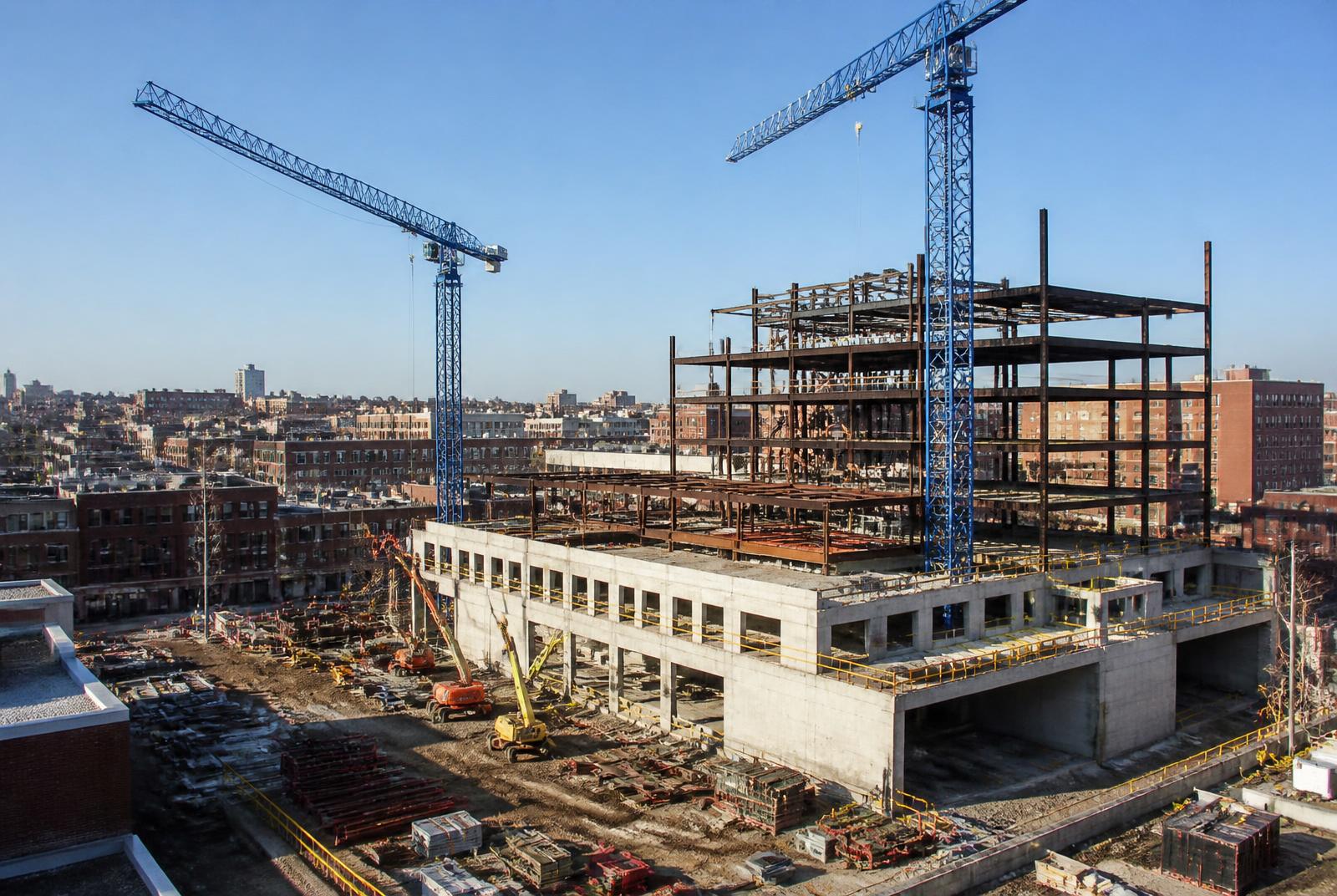
Tower cranes over a new mid-rise construction site in South End Charlotte

Growth & Zoning

South End's Development Pipeline

South End has been one of Charlotte's most active development corridors for years, with transit-oriented zoning setting the terms for what gets built and where the next wave of change is likely to land.

TOD

zoning framework along the Blue Line

Mid-rise

typical scale of new construction

Mixed-use

dominant project type

Ongoing

pace of new permits filed

The Zoning Framework Behind the Boom

Much of South End's new construction traces back to the transit-oriented development zoning applied along the LYNX Blue Line corridor, which allows greater height and density near stations in exchange for pedestrian-oriented design standards at street level.

That framework replaced older industrial zoning that had limited South End to lower-intensity uses for decades, and it opened the door to the mid-rise apartment and mixed-use buildings that now dominate blocks near Carson, Bland Street, East-West Boulevard, and New Bern stations.

Charlotte's Unified Development Ordinance carries forward much of this station-area logic today, meaning new projects filed in South End are typically evaluated against standards built around walkability and transit access rather than purely conventional suburban zoning categories.

What's Currently Rising

The development pipeline in South End remains active, with permitted and under-construction projects skewing toward mixed-use buildings that pair ground-floor retail with apartments or office space above.

Sites closer to the Rail Trail and the LYNX stations tend to draw the most competitive, highest-density proposals, while parcels further from transit — closer to Wilmore or Sedgefield's edges — see a mix of smaller-scale infill and occasional larger projects.

Older single-story commercial buildings and surface parking lots remain the most common redevelopment targets, since their land value now often exceeds what's built on them, making a teardown-and-rebuild economically attractive to owners and developers.

How Projects Move Through the Pipeline

New South End developments generally start with a rezoning petition if the site isn't already zoned for the intended density, followed by site plan review, permitting, and then construction, a process that can take a couple of years or more from initial filing to breaking ground.

Community input sessions are typically part of the rezoning process, and South End's neighborhood and business groups have been active participants in shaping specific project conditions, from building setbacks to affordable housing commitments.

Once a project has an approved rezoning and permits in hand, construction timelines vary widely depending on building type, financing conditions, and site complexity, meaning the visible pipeline at any given moment includes projects at very different stages of readiness.

What Growth Means for Current Residents

For renters and owners already in South End, the pipeline's pace affects everything from parking availability to construction noise to the mix of retail on a given block, since new buildings can displace surface lots or older low-rise storefronts residents had grown used to.

Rising land values tied to new development have also pushed up costs for both renting and buying in the district, a pattern consistent with other Charlotte neighborhoods that saw concentrated transit-oriented investment.

At the same time, the pipeline has brought a steadily growing base of restaurants, grocery options, and services within walking distance for residents, an amenity trade-off that many South End buyers and renters weigh explicitly against the cost and density increases.

  • New construction concentrated near LYNX stations and the Rail Trail
  • Older surface lots and single-story buildings are common redevelopment targets
  • Rezoning typically includes community input sessions
  • Rising density has come with rising costs and expanded amenities alike

Where Growth Is Slowing or Shifting

Some of the most intensely developed blocks near Atherton Mill and Carson station have less readily available land left, pushing new project interest further south toward East-West Boulevard, New Bern, and the edge of LoSo.

That southward shift has made those station areas a bellwether for where South End's next visible wave of construction is likely to concentrate, even though they currently feel less dense than the northern core.

Some longtime industrial and light-commercial parcels in the district's southern half remain undeveloped for now, either due to ownership structure or site constraints, representing the clearest remaining opportunities for large-scale projects.

Tracking the Pipeline Yourself

Anyone trying to follow South End's development activity can review pending rezoning petitions and building permits through the city and county's public planning and permitting resources, which list project addresses, proposed uses, and current status.

Attending community meetings tied to specific rezoning petitions is another direct way to see what's proposed before it becomes visible on the ground, since these sessions often happen well before construction fencing goes up.

For residents specifically concerned about a nearby parcel, checking whether a rezoning petition has been filed is usually the fastest way to get a sense of what might change on that site in the next few years.

At a glance

What matters most here

TOD Zoning Baseline

Station-area zoning allows greater density in exchange for pedestrian-oriented street-level design.

Southward Shift

New project interest is increasingly moving toward East-West Boulevard and New Bern station areas.

Public Rezoning Process

Most significant projects pass through community input sessions before approval.

Orientation

Where this sits in South End

Everything in the district is measured against the Blue Line and the Rail Trail. Use the map to place the blocks referenced above.

N ↑Morehead StEast/West BlvdTremont AveUptown CharlotteCarson StationBland Street StationEast/West Blvd StationNew Bern StationCharlotte Rail TrailAtherton MillDesign DistrictBrewery RowWilmoreDilworthSedgefieldLoSoLowe's Tech Hub

Interactive map

Hover or tap a marker

The Blue Line runs the length of South End on a northeast–southwest diagonal, with the Rail Trail beside it. Nearly everything in the district is measured by how far it sits from that spine.

  • Blue Line station
  • Landmark
  • Sub-district
  • Employer / anchor

Answered

Questions & Answers

What is driving South End's development boom?

Transit-oriented development zoning along the LYNX Blue Line corridor allows greater density near stations, which has made South End one of Charlotte's most active redevelopment areas.

Source: City of Charlotte Unified Development Ordinance (2023)

What types of buildings are currently being developed in South End?

Mixed-use buildings combining ground-floor retail with apartments or office space above are the dominant project type in the current pipeline.

Source: Charlotte Regional Business Alliance

How long does it take for a project to go from proposal to construction?

It varies, but the rezoning, review, and permitting process typically takes a couple of years or more before construction begins.

Source: City of Charlotte / Mecklenburg County Code Enforcement permitting

Is South End's growth affecting housing costs?

Yes, rising land values tied to development have pushed up both rental and ownership costs in the district, consistent with other transit-oriented Charlotte neighborhoods.

Source: City of Charlotte Unified Development Ordinance (2023)

Where is new development moving next in South End?

Activity is increasingly shifting south toward the East-West Boulevard and New Bern station areas as land closer to Atherton Mill and Carson station becomes scarcer.

Source: Charlotte Area Transit System — LYNX Blue Line

How can residents track proposed projects near them?

The city and county's public planning and permitting resources list pending rezoning petitions and permits, and community meetings tied to specific petitions offer an earlier look at what's proposed.

Source: City of Charlotte / Mecklenburg County Code Enforcement permitting

Primary Sources

Figures are compiled from public records and primary sources and are reviewed periodically. Conditions in South End change quickly — verify anything you intend to rely on.