Journal — June 7, 2026
A Walkable Weekend Route Through South End
A grounded two-day walking guide across Charlotte's South End, linking the Rail Trail, historic borders, and transit-connected corridors.
South End occupies a distinct linear geography in Charlotte, arranged around the steel tracks of the LYNX Blue Line rather than a traditional town square. For decades an industrial manufacturing and warehousing district, the area within the 28203 zip code has become the city's densest urban enclave. Navigating it on foot over two days reveals how industrial architecture, mid-century commercial pockets, and newer residential towers interface with one another. While vehicular traffic along South Boulevard is persistent and often congested, a network of paved paths, residential street grids, and rail stops allows a traveler to move through the entire district without a car. This route moves deliberately from north to south, balancing active commercial arteries with quiet residential transitions.
Saturday Morning: The Rail Trail Spine and the Wilmore Border
A weekend on foot begins logically at the northern fringe of South End, near Carson Station where the neighborhood meets the high-rise silhouette of Uptown. The Charlotte Rail Trail runs directly parallel to the light rail tracks, providing a flat, uninterrupted pedestrian pathway separated from vehicular traffic. Walking south from Carson toward Bland Street, the physical character of early twentieth-century mills is visible in the preserved brick facades and low-slung warehouse footprints that now house offices, bakeries, and small specialty retail. The morning pedestrian traffic here consists largely of local runners, dog walkers, and commuters heading to the stations.
To understand the geography beyond the central transit corridor, turn west along Kingston Avenue into Wilmore. Within two blocks, the scale drops from seven-story apartment structures to quiet, tree-lined residential streets laid out in the 1910s and 1920s. Craftsman-style bungalows sit alongside contemporary infill homes, illustrating the sustained redevelopment pressure documented across Mecklenburg County land records. Walking the perimeter of Wilmore before looping back east offers shaded sidewalks and a slower rhythm that counterbalances the concrete and metal surfaces along the rail right-of-way.
Saturday Midday to Dusk: Central South Boulevard and the Dilworth Margin
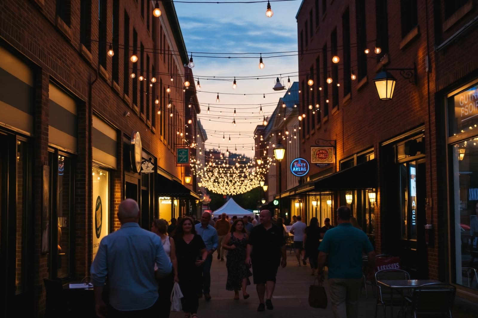
Re-entering the central corridor around East/West Boulevard Station brings you into South End's highest concentration of foot traffic. Midday pedestrian patterns cluster around outdoor patio dining, converted manufacturing spaces, and casual lunch counters. South Boulevard itself carries heavy through-traffic and features narrow curbside sidewalks in older segments; walkers will find a much more comfortable environment by remaining on the Rail Trail or using parallel side streets such as Camden Road, where street trees, outdoor seating, and wider sidewalks buffer foot traffic from passing cars.
As the afternoon deepens, cross east across South Boulevard toward the edge of Dilworth. This boundary marks the transition between industrial rail facilities and Charlotte's earliest streetcar suburb. Along streets like Tremont and East Boulevard, the environment softens into mature oak canopies and historic residential architecture. Spending late afternoon on the Dilworth edge allows for unhurried browsing through design studios, independent bookshops, and neighborhood markets. Conclude the evening back along the central dining corridor near Bland or Tremont, where adaptive reuse buildings keep evening crowds concentrated in compact, walkable blocks.
Sunday Morning: The Historic Atherton Core and Sedgefield Paths
Sunday morning is well suited to examining the industrial heritage anchoring the southern part of the historic core. The area around Atherton Mill represents one of the neighborhood's earliest textile hubs, dating to the late 1890s. The Charlotte-Mecklenburg Historic Landmarks Commission archives detail how the preserved brick buildings, smokestacks, and high timber ceilings were repurposed to create a continuous retail and market complex. On weekend mornings, the open-air market brings regional produce growers, bakeries, and craftspeople into the courtyards, creating a dense but orderly morning gathering space.
From Atherton, walk southward along the path toward the New Bern Station area, skirting the northern edge of the Sedgefield neighborhood. Here, the landscape transitions again. Newer five-to-eight-story residential developments line the tracks, but crossing Marsh Road into Sedgefield introduces mid-century single-family streets and small neighborhood parks. The elevation shifts slightly here, offering clear views back north toward the Uptown skyline through the trees. It is a quiet segment of the walk, ideal for observing how the district's rapid residential expansion interfaces with long-established neighborhood borders.
Sunday Afternoon: Lower South End Industrial Repurposing
The southernmost segment of the itinerary explores Lower South End, colloquially known as LoSo, primarily accessed via the Scaleybark light rail station. Historically zoned for light industry, distribution facilities, and metal fabricators, this district features wide warehouse bays, corrugated metal siding, and open concrete yards. Over the last decade, these spacious structural footprints have been adapted into craft beverage facilities, climbing gyms, and creative production spaces.
Walking conditions in LoSo require more attentiveness than the northern Rail Trail. Sidewalk networks are intermittent in certain industrial pockets, and walkers share rights-of-way with active commercial vehicles and rail spurs. The City of Charlotte open data portal outlines ongoing capital investment projects designed to link missing sidewalk segments throughout this area. Navigating the sector on foot provides an honest look at a neighborhood mid-transition, where raw industrial utility sits side by side with modern public entertainment venues.
Transit Logics, Grade Crossings, and Practical Footwork
Walking South End effectively requires understanding the cadence of the LYNX Blue Line. Trains run along the corridor at steady intervals throughout the weekend, as detailed on schedule boards published by the Charlotte Area Transit System (CATS). Rather than walking the full length back and forth, a practical strategy is to walk the itinerary linearly from north to south across the two days, then use the light rail to return to your starting point within minutes.
Pedestrians should also pay close attention to designated grade crossings. Tracks cross major surface streets at East Boulevard, Tremont Avenue, and Bland Street, where automated crossing gates and audible signals regulate train arrivals. Attempting to cross the tracks away from marked concrete walkways is strictly prohibited and dangerous. Sticking to established crosswalks, keeping to the right on multi-use paths, and watching for micro-mobility devices like electric scooters ensures a safe, predictable route across the district.
What to take from this
- Use the Charlotte Rail Trail as your primary pedestrian spine to avoid the noise and narrow curbs of South Boulevard.
- Wilmore to the west and Dilworth to the east provide shaded, residential detour routes with historic early-1900s architecture.
- Lower South End has larger warehouse footprints but intermittent sidewalks, requiring extra pedestrian care along industrial side streets.
- Pair your walking route with the LYNX Blue Line to eliminate backtracking between northern and southern district sections.
Figures in this district move faster than any page can. Verify parcel data, assignment zones, and transit schedules with Mecklenburg County, CMS, and CATS before acting.
More journal entriesAnswered
Questions & Answers
- Is South End Charlotte walkable without having a car?
Yes. The central corridor of South End is one of Charlotte's most walkable environments. The Charlotte Rail Trail links residential buildings, grocery stores, dining, and transit stations along a flat, continuous path, making personal vehicle use unnecessary for a weekend stay.
- How long does it take to walk the full Rail Trail in South End?
The primary South End section of the Rail Trail runs roughly 3.5 miles from Carson Station to south of New Bern Station. At an average walking pace without prolonged stops, completing this linear segment takes between 60 and 80 minutes.
- Where can I find public parking if I drive into the neighborhood to walk?
Paid parking decks are situated near major stations, including Atherton Mill and Bland Street. Metered on-street parking exists along side streets, but availability is limited on weekends. Public parking regulations and surface lot fees should be checked through City of Charlotte signage.
- How frequently does the LYNX Blue Line run on weekends?
Weekend trains generally operate on standard 15-to-20-minute headways from early morning until late evening. Travelers should confirm real-time arrival estimates and scheduled service adjustments directly through the Charlotte Area Transit System (CATS) app or website before setting out.
Primary Sources
- City of Charlotte
- Mecklenburg County POLARIS 3G parcel viewer
- Mecklenburg County Assessor's Office property records
- Charlotte Area Transit System — LYNX Blue Line
Figures are compiled from public records and primary sources and are reviewed periodically. Conditions in South End change quickly — verify anything you intend to rely on.
The Local Network
Four firms we recommend by name
South End rewards specialists. These are the people we send readers to for building, buying, designing, and wiring a home in this district — read our coverage, or go straight to their studios.
Custom Builder
Peters Custom Homes
Estate-grade custom construction and infill homes across Charlotte, including 28203 teardowns and full gut renovations.
peterscustomhomes.com Our coverage →Real Estate
Peters & Associates
Representation for buyers and sellers in South End's condo, loft, and townhome market — plus off-market building intelligence.
yourleaderinluxury.com Our coverage →Interior Design
Emerald & Oak
Full-service interior design and furnishing for hard-loft volumes, tower residences, and new construction.
emeraldoakdesign.com Our coverage →Smart Home & AV
Peters Audio Video
Networking, lighting control, media rooms, and whole-home audio engineered for concrete-and-steel construction.
petersaudiovideo.com Our coverage →